Fresh Kills at Queens Museum

This past Friday, I was invited to speak about my book before the annual investors conference for the 22nd Annual Investors conference of the NYC Municipal Water Finance Authority. It took place at Queens Museum, which coincided with Maintenance Art, an exhibit on the ecology, history, and future of Fresh Kills by Mierle Laderman Ukeles.

freshkills ukeles1.jpg

The central piece of the exhibit was a model of Landing, an overlooks inside the dump-turned-park that will offer visitors a view of the city’s largest naturalistic landscape. What’s an architecture piece from Staten Island park doing at the Queens Museum? Continue reading

Alice Austen House, Staten Island

When I first read that there was an Austen House Museum on Staten Island, I mistakenly thought that it had something to do with a Victorian period British novelist. Both the novelist and this house’s namesake came from the upper class. Both Jane Austen and Alice Austen were fiercely independent women. Neither had ever married. The comparison ends there.

But what concerns me for the purpose of this blog is the landscape around Alice Austen’s House.

20160902_132529

There is a brook flowing on the south side of the house, emerging from the grass and descending down to the Narrows, the strait connecting New York Bay to the ocean. Continue reading

Peer Reviewed Book

When an author has a book reviewed by a peer, it is an experience that is at once exciting but also anxious. What would he say about my book? Is it deserving of his review? I am proud to have had my book read and reviewed today by The Bowery Boys, a blog founded by Greg Young and Tom Meyers. Since 2007, they’ve recorded podcasts of city history available to the public on their website and through iTunes, among other platforms.

silverlake 1915.jpg

Click on the above 1915 postcard of Staten Island’s Silver Lake to read the full review and interview on Hidden Waters of New York City by The Bowery Boys. Last month, they recently released a book of their ownBowery Boys: Adventures in Old New York is available at all online book retailers including the venerable Strand Books.

Wallabout Creek, Brooklyn

A half mile to the south of Williamsburg Bridge, the East River makes a turn to the southwest with a wide cove at this knee-shaped bend. Known as Wallabout Bay, it was the site of a notorious floating prison during the Revolutionary War and the Brooklyn Navy Yard. At the northwestern corner of this property, a deep channel cuts inland as the only remnant of Wallabout Creek.

cob 3.jpg

In the second third of the 19th century, the bay had an artificial island in its middle, Cob Dock, a part of the Brooklyn Navy Yard accessible by the ferry seen in the above postcard. The bay and its feeder stream, Wallabout Creek have a long and storied history. Continue reading

Bassett Creek, Minneapolis

In the northern Midwest near the headwaters of the great Mississippi River are the “Twin Cities” of Minneapolis and Saint Paul. The former is the largest city in Minnesota while the latter is the capital city. On account of its post-glacial landscape, the state is nicknamed Land of 10,000 Lakes, and Minneapolis’s name is a portmanteau of the Sioux word for water and the Greek word for city.

bass 1.JPG

One such example is Bassett Creek, which flows for 12 miles from its source at Medicine Lake to its confluence with the Mississippi near downtown Minneapolis. The photo above shows the creek emerging from its sewer in a cove just a few yards shy of the Mississippi River. In the suburbs, the creek runs through a few parks, but its final 1.7 miles are in a tunnel, constructed in the early 20th century beneath an expanding city.  Continue reading

Clifton Lake, Staten Island

As the last borough in the city with substantial undeveloped land, Staten Island also has the largest number of hidden waterways in the city. On a dead-end one-lane road just north of Fort Wadsworth is a rare privately-owned pond.

clifton 3

Located in the Shore Acres residential enclave, this kettle pond is situated entirely within private land, divided between three properties. In 1924, photographer William J. Grimshaw was given access to the pond, which hasn’t changed much over the decades, except for a fence to keep outsiders out of the water. Continue reading

Photo of the Week

For the past forty years southern Brooklyn has been a magnet for Russian-speaking immigrants, nicknamed Little Odessa for its waterfront. One feature of this coastline is Sheepshead Bay, mistakenly nicknamed “the canal” by some newcomers but in reality, named after a fish whose image appeared on the first hotel in the neighborhood.

sheeps 1.JPG

Formerly a tidal strait that separated Coney Island from mainland Brooklyn, it was given a seawall shoreline in 1936, as seen in this photo from the NYPL Digital Collections. Continue reading

Coe’s Mill, Queens


The street behind Forest Hills Cooperative Houses skews off the grid by a few degrees and was part of the ancient North Hempstead Plank Road. Reflecting its history, the one-block road is named Colonial Avenue. For nearly three centuries, the road traversed a small island in the middle of Horse Brook. On the island were a gristmill and a hotel. 

coe 1.jpg

In 1930, the Long Island Expressway obliterated all traces of the mill and its island, which was no wider than the highway. So much of early Queens history is associated with this mill, perhaps even the reason why today we speak English instead of Dutch. Continue reading

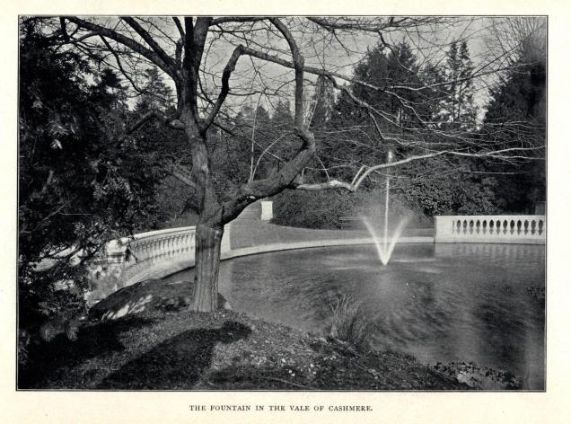
Vale of Cashmere, Brooklyn

In the knob and kettle terrain of Brooklyn’s Prospect Park, there is a natural valley sculpted by glaciers that was transformed by the park’s designers into a miniature Eden with reflecting pools and gardens.

cashmere postcard.jpg

It was named after a valley in Kashmir, the mountainous region straddling the India-Pakistan border. After decades of neglect, this section of Prospect Park is receiving renewed attention with a restoration project underway. Continue reading

Bergen Basin, Queens

Continuing on the southeast Queens theme, here’s another hidden waterway visible to countless airplane passengers but nearly inaccessible on the ground to the public.

bergen 1.JPG

Flanking the western edge of JFK International Airport, Bergen Basin has been used mainly for fuel deliveries to the airport’s massive tank farm. Prior to the construction of the airport, the highly polluted basin was an inlet of Jamaica Bay, site to a fishing community long forgotten. Continue reading