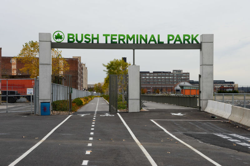
On the industrial waterfront of Brooklyn’s Industry city is a new park with two obscure entrances that offers sweeping views of New York Harbor. Bush Terminal Park opened in 2014 on a reclaimed stretch of shoreline that previously operated as a seaport.

The park offers a naturalistic scene on a harbor ringed by piers and warehouses in a corner of Brooklyn that is lacking in sizable parks.
Where It Is

The park lies on the shoreline between 44th and 50th Streets near the Sunset Park neighborhood. It is comprised of a waterfront promenade, jetty that borders two tidal ponds, a forested peninsula, sports fields, and riprap on the water’s edge.
Prior to being designated as a park, this land was a brownfield, a designation that resulted from pollutants being illegally dumped here in the 1970s as water between the four piers of Bush Terminal was filled with construction debris.
When the city discovered that there was also oil, sludge, wood, and wastewater being dumped here, the land reclamation operation stopped in 1978. For the next three decades the land lay unused as the city and state worked on funding the brownfield cleanup of this property. At the same time, the recognition that Sunset Park only has one large park, and eight playgrounds (including schoolyards) within a 30-block length. The creation of Bush Terminal Park opened up new athletic open space in a neighborhood starving for parks that has long been kept away from its waterfront.

Looking at the 1916 map of Bush Terminal, we see seven piers jutting into the harbor serving 17 steamship lines. Train tracks on the piers took the goods onto freight trains that transported materials inland. Two blocks away from the shore, Third Avenue was shrouded by an elevated subway line that was repurposed in 1936 as the Gowanus Expressway.
Freight tracks running on First Avenue and Second Avenue connected to piers and warehouses in a scene reminiscent of Manhattan’s West Side freight line before it was elevated as the High Line.
Between Owl’s Head in Bay Ridge and Brooklyn Bridge, there was not a single spot where the public could access the harbor. The entire shoreline was industrial, lined with piers, wharves, quays, and barge lifts. There were no parks anywhere on the Brooklyn waterfront, the exceptions being the Olmsted-designed Shore Road and Owl’s Head in Bay Ridge.
Bush Terminal Company

The history of this park is closely tied with its namesake, industrialist Irving T. Bush (1869-1948) who founded the Bush Terminal Company here in 1902. The NYC Department of Records & Information Services blog goes into great detail on the company and its impact on the city. He was not related to the Bush political family, but also has deep roots in the country as a descendant of Dutch settlers.
The story began with Rufus Bush who operated an oil refinery in this area between the 1850s and 1880s. Rockefeller’s Standard Oil monopoly bought Bush’s refinery, leaving him rich and his son later worked for the company. His father’s land was expanded into the harbor using ash as landfill, the same material that covered Flushing Meadows.

At the turn of the 20th century, Irving avenged the loss of his father’s land by purchasing it back form Standard oil with the goal of establishing a 200-acre seaport. Instead of being bottlenecked on Manhattan’s crowded piers and streets, Bush’s piers provided easy access for goods to markets on Long Island, and using freight barges, to points west in New Jersey and beyond. Using the link to the LIRR Bay Ridge Branch, trains ran across Brooklyn towards Hell Gate Bridge and New England. The freight pier operation ended in 1974 as larger container ships made Newark Harbor their port of call. As with the piers of Manhattan, those on the Brooklyn side also became derelict.
Sights to See

On the northern side of the park, the partially filled space between piers 3 and 4 was redesigned as tidal lagoons where the water rests during low tide and reconnects with the harbor when the tide is high. The idea is to create ideal habitat for wildlife in calm water. Pier 4 was fortified with boulders and provides a windswept dead-end walk into the harbor from which the Statue of Liberty can be seen unobstructed and without the tourist crowds. The three-story red brick house behind pier 4 is the former office of the Bush Terminal Company, its name still appearing prominently on the building. Downtown Manhattan looms in the background.

The park’s comfort station is not the typical square brick house but a set of repurposed shipping containers fitting with the history of this park. For now it stands alone but long-term plans for this park include an environmental education center to give it company.

At the southern tip of the park one can find a storm sewer drain where excess sewage enters the harbor. As the city expands the capacity of its water treatment plants and green infrastructure, such drains will carry less water into the city’s streams.

At the tip of the former pier 1 one sees the downtowns of Manhattan and Jersey City with the Hudson River separating them. The harbor here appears deep but in reality there are channels and shoals under the water’s surface. The Bay Ridge Channel closely follows the shoreline between the mouth of Gowanus Canal and Bay Ridge.

It is separated from the center of the harbor by a reef that is avoided by large ships. In the early 20th century, there were proposals to elevate Bay Ridge Flats above the surface as a freight dock, but at this point in history concern for wildlife habitat likely means that New York will not see any dramatic extensions of its land into the sea. This contrasts with Hong Kong and Singapore, which continue to expand in size by building into the sea.

Rather than an artificial island with a seawall edge (as seen on governors, Ellis, and Liberty islands) the more forward-looking proposal for New York Harbor is the 2010 Palisade Bay proposal that appeared in the 2009 MoMA exhibit titled Rising Currents: Projects for New York’s Waterfront. Planted reefs established atop Red Hook Flats would serve to create a habitat and mitigate the impact of storm surges. It would change the views that one currently experiences at Bush Terminal Park from a wide open harbor to one filled with aquatic plants and islets of green, a living harbor once dominated by industry.
Read More:
Bush Terminal Park represents the post-millennial generation of waterfront parks that also includes Barretto Point Park, Bushwick Inlet Park, Gantry Plaza State Park/Hunters Point South, Hudson River Park, and a few others that have revolutionized the city’s relationship with its waterways.

5 thoughts on “Bush Terminal Park, Brooklyn”