In my Out of Town feature, I hadn’t yet featured a hidden urban waterway in the Oceania part of the world. In the southern hemisphere so far, I’ve only written about Tank Stream in Sydney, Australia. After a careful search, I’ve zoomed in on the only American territory on this half of the globe, American Samoa. Its capital Pago Pago is conveniently situated at the head of a harbor which collects water from a dozen streams. The one with the largest watershed is the 1.7-mile Vaipito Stream.
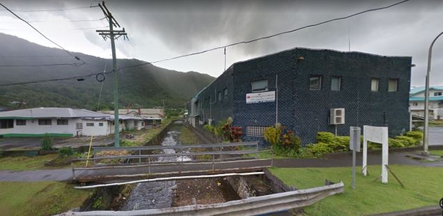
I can’t imagine when I would have the opportunity to visit Pago Pago. Fortunately Google Maps took its car and camera there in 2014. Above is a view of Vaipito looking downstream from Route One.
Where it Flows

Looking at the 1989 USGS topographic survey of Tituila Island, I outlined the approximate watershed boundaries of the Vaipito and the stream. Its furthest headwaters are on the tributary Utumoa Stream, flowing down from the ridge that stretches between Matafao Peak and Fatifati Mountain. In total, Vaipito has five named tributaries flowing into it.
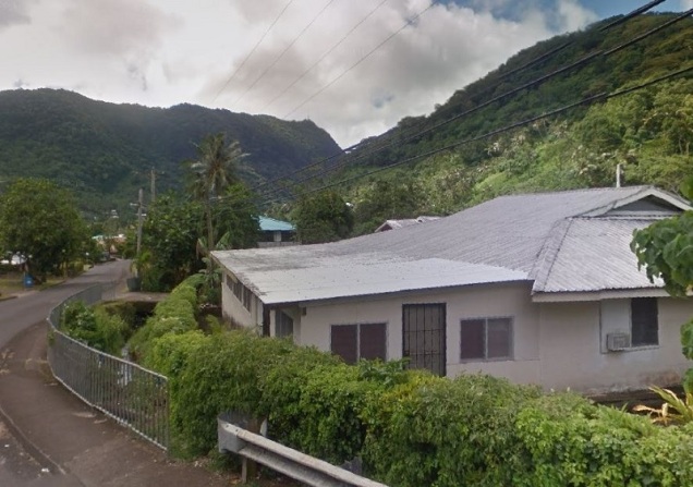
As often happens, river valleys offer the least challenging topography, making them ideal for settlement. As the map shows, the stream is followed by Route 5 with homes clustered tightly along this road. Many of the properties along Route 5 have Vaipito Stream serving as a natural moat, with driveway bridges crossing it.

The tropical rainforest climate ensures that Vaipito always has water and its banks have been known for pottery finds dating back centuries, hinting at pre-colonial communities. Unfortunately, I couldn’t find a Samoan translation online for the stream’s name. Google Translate has it as “Waste Stream.” Could such an unseemly name really be the translation for Vaipito? Any help here would be greatly appreciated.

At Route One, looking upstream, the creek is clearly seen as the bottom of the valley sharing its name. It is barely visible amidst thick vegetation.

Not too far from Route One crossing the Vaipito is Laolao Stream, which flows into the head of the harbor. Here it flows through Pago Pago Park, merging with Vaipito a few yards shy of the harbor. This u-funnel in the harbor that is Pago Pago Park has an unusually flat terrain, ideal for sizable items such as a football field.

As shown on this 1992 survey prepared for the US Army Corps on Engineers, the park has plenty of potential for development as the territory’s main recreational area. The map was prepared for a survey seeking to build a shortcut road across the stream’s mouth. Nearly forty years after its was first proposed, the bypass road has yet to be built.
As we have seen with Hurricane Maria in 2017, most mainland Americans are not aware of their country’s colonial possessions, such as Puerto Rico and the Virgin Islands. In that respect, American Samoa is even lesser known, being the country’s only territory in the southern hemisphere, whose citizens are U.S. nationals, but not citizens. And yet, Samoans disproportionately serve in the military for the career opportunities that it provides.
If not for its distance, American Samoa has great tourism potential, on account of its rich biodiversity, complex geology, long human history, and its own National Park. Even if you’ve never though about American Samoa before, there’s a good chance that your canned tuna comes from there.

One thought on “Vaipito Stream, Pago Pago”