Toronto, Canada is often compared to New York based on its diversity, street grid and downtown. Its grid is laid out atop numerous buried streams that have a devoted following that follows their courses. One of those streams is Garrison Creek, named after the fort where the city began.

As the stream’s name indicates, in the early years of Toronto, it had a close connection to Fort York, the military base near its mouth that was built to repel an American invasion. It had a key role in the development of the city as the source of its water. With industry encroaching, pollution drove the stream beneath the surface, but a revival of sorts in now underway.
Parks Along the Way

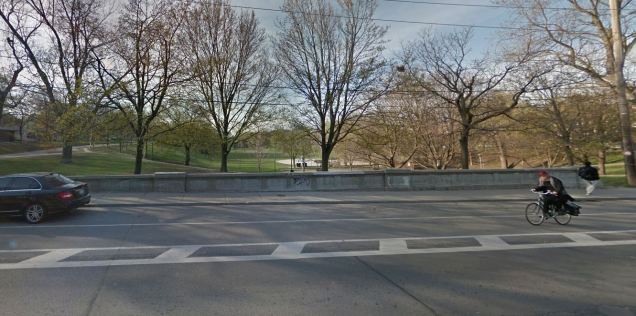
On the 19th century map above, present-day parks located atop the stream bed are marked in green. They are nearly close enough to each other to form a linear ribbon of green where blue once flowed. Examples of such parks include Christie Pits, Dufferin Grove and Trinity Bellwoods. Within these parks, a valley landscape marks the former course of Garrison Creek. Some of the streets running through and alongside these parks have concrete sides indicating former bridges that are now firmly on the ground as the valley was raised using landfill.
Fort York

First constructed in 1793 by the British to maintain their hold on Canada, Fort York stood on the shore of Lake Ontario, at the point where Garrison Creek flowed into it. Flowing through a steep ravine, the creek formed a natural northern palisade for the fort. In 1813, U. S. forces invaded Fort York and occupied it for six days but in the end, the War of 1812 was a stalemate. The United States kept its independence while Canada remained a loyal British possession for another few decades. The fort remained in use as a military facility as recently as the Second World War. In the aerial view below, the course of Garrison Creek lies beneath the train tracks on the fort’s northern side. The fort’s outline is marked in red.

As the late 19th century image below shows, the grid was closely encroaching on the ravine of Garrison Creek. On its eastern side, Niagara Avenue skews from the grid by following the edge of the ravine.

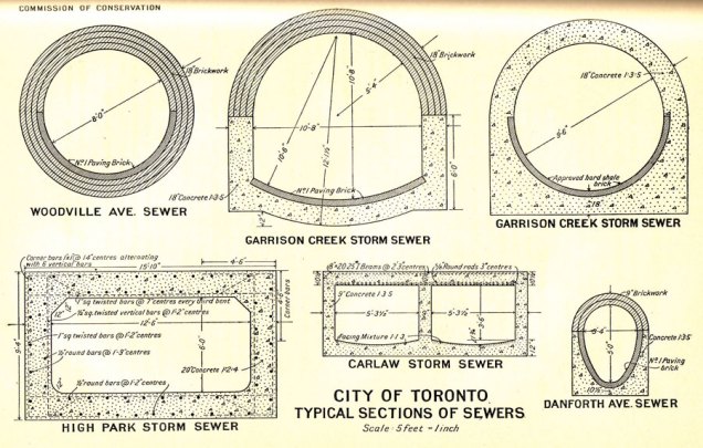
By the 1930s, the creek appeared in diagram form as a sewer beneath the streets.
Marking Garrison Creek
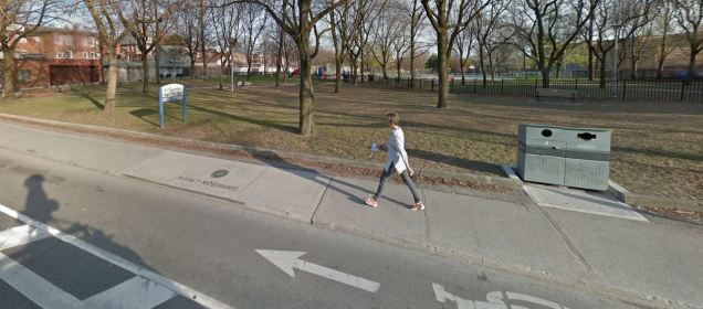
The largest park along the stream bed is Trinity Bellwoods Park, a former ravine that was raised using fill from subway excavations in the 1960s. The park’s namesake is Trinity College, which had its campus here between 1852 and 1925. With the dried-up ravine gone, the only hint of the stream’s course is the park itself. Within the park however are manholes, sidewalk markers and relief maps of Garrison Creek.


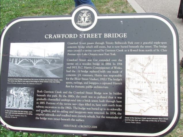
Crossing the park, Crawford Street appears flat but a helpful historical sign reminds visitors that beneath them is a bridge completely covered by earth.
Below are images from the city’s archives showing the transformation of Crawford Street and Garrison Creek.
A detailed timeline of Garrison Creek can be found here. Hidden urban streams have a history of reappearing where they once flowed and Garrison Creek did just that in 2013, flooding low-lying areas along its former course.
Along the Course

In the Davenport neighborhood on the city’s north, a one-block park along the freight tracks between Ossington Avneue and Shaw Street is named for the creek. Similar sized parks in Toronto are known as parkettes, a program known to New Yorkers as vest-pocket parks.
A half mile to the south, Christie Pits Park takes its name from a sand pit in the bowl-shaped landscape.

On the south side of the park, an abutment on Harbord Street marks a former bridge. The abutment faces Christie Pits Park.
Across the street, Art Eggleston Park also lays atop the buried stream with a sidewalk marker in its memory.
Among the parkettes along the stream’s course is Roxton Road Parkette, which features a decorative canoe as a reminder of the stream.

So when you’re in Toronto, look for the manholes indicating the stream flowing beneath them. Currently, the city has nine streams marked on its map.
A more detailed flood map however, shows valleys prone to flooding that hint at a much larger network of creeks that one existed above the surface.

The history of Garrison Creek has been well-researched and documented with amazing posts by the urban history site Lost Toronto. To uncover the creek even more, I recommend a look at this amazing, interactive, map-filled timeline created by public historian Alex Meyers. Along with manholes and sidewalk markers, the Garrison Creek Discovery Walk also enables the public to follow the creek’s course.

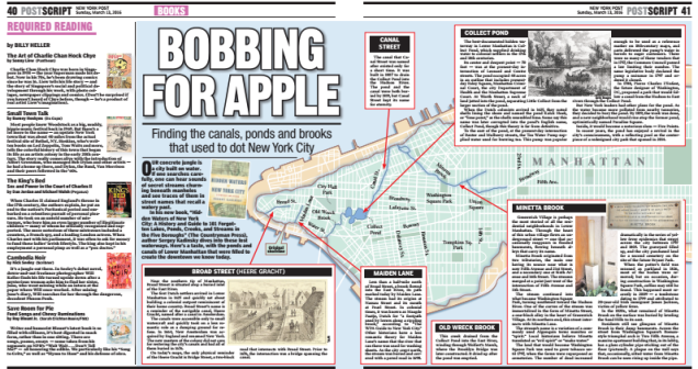
In the News: I made yesterday’s New York Post book review.

Good to see this profile about Toronto. The picture you have of Christie Pits Park that you nicked from my blog is actually Bickford Park, though. Similar geographies and histories — Christie Pits was a sand mine and Bickford was a clay mine.
LikeLike
My apologies. Thank you for the correction and I appreciate your work in raising awareness.
LikeLike